
Some rather interesting and, at times, hair-raising events
By Ray Walls and Peter Burlong; ex Airborne Navigation Aids Development
In the early 1960s, the Aeronautical Division (as it then was) of The Marconi Company developed the world’s most successful and widely used civil Doppler Navigation System – the AD 560. The first customer was BOAC for its Vickers VC-10 and Super VC-10 fleets. Subsequently it saw service with some thirty-five other long-haul airlines including QANTAS, Air New Zealand and South African Airways in Boeing 707 and Douglas DC-8 aircraft. A high-speed variant, capable of operating at Mach 2.0, was fitted to the prototypes of the BAC/Aerospatiale Concorde.
 Prior to entry into service the division carried out extensive flight trials to confirm the accuracy of the distance flown and velocity measurements, the lock/unlock performance over smooth surfaces such as a flat calm sea and the overall system accuracy, including the Track-Guide Computer.
The aircraft used for these trials was a Vickers Viking 1B, G-AHOP shown above. This was a civil derivative of the WW2 Wellington bomber designed by Barnes-Wallis.
The trials team, in addition to the two pilots, comprised an observer, a cam-era operator and four or five engineers to operate recording equipment and take notes of the system’s performance. As flying at very low altitudes (typically 500ft) could be turbulent, a prime requirement was a strong stomach.
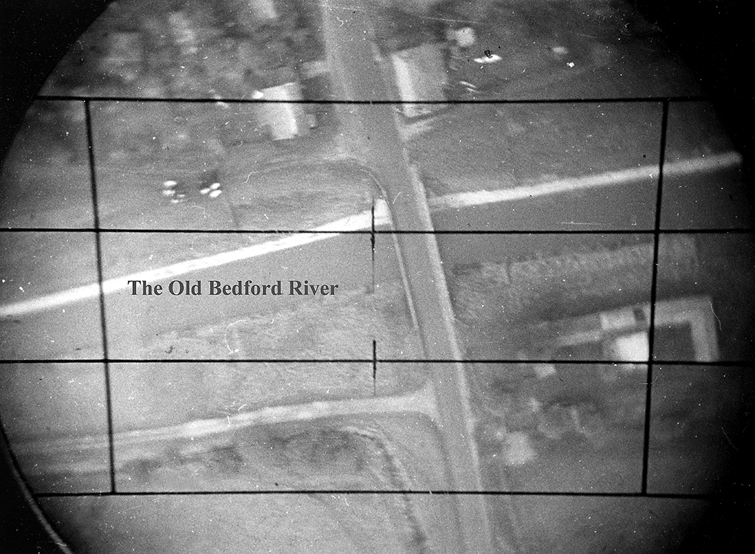
The tests to confirm the accuracy of the distance flown and velocity measurements were carried out along an 18nm straight stretch of canal (the Bedford Levels) from Earith in Cambridgeshire to Denver Sluice near Downham Market in Norfolk. Easily identifiable ‘fix’ points (intersections of roads or the railway with the canal) at the start and end of the run and at seven intermediate points were established. These ‘fixes’ were photographed using a single-lens reflex camera coupled to a drift-sight that looked vertically downwards from the aircraft. The system output a pulse every 0.1 nautical mile. These pulses were recorded on paper tape together with a pulse from the flash contacts of the camera. Thus we were able to determine accurately the distance measured by the system between fixes. The photographs were compared to large-scale maps to determine the accuracy of the fixes and these, in turn, enabled us to correct the recordings on the paper tapes. A typical fix point as seen through the drift sight is shown below.
 In order to investigate ‘height-holes’, a phenomenon of the frequency modulated continuous wave (fmcw) techniques employed by AD 560, a series of runs was carried out at altitudes between 500ft and 1500ft at 100ft increments, ie out at 500ft, back at 600ft, and so on. The aircraft was not equipped with a radar altimeter so in order to determine our altitude accurately we sought to make the best use of the data available to us. We concluded that the optimum method was to use the geometry of the camera/drift-sight combination together with the width of the roads at the fix points to calculate the aircraft’s altitude. In order to facilitate this, a young engineer, armed with a surveyor’s tape, was despatched to Norfolk on a Saturday morning to measure the width of all the roads and bridges at the desired locations. Fortunately in those days traffic in rural Norfolk was pretty light!
The flights were seldom uneventful and were subject to some rather interesting and, at times, hair-raising events. As the northern end of the canal, near Downham Market, was fairly close to the approach path into RAF Marham and the southern to RAF Wyton, it was sometimes necessary to effect a sharp left-hand turn after making the final fix in order to avoid aircraft landing at the bases. On one occasion we weren’t quite quick enough and the aircraft was thrown about quite violently. On looking out of a side window, one of the engineers noticed a Victor bomber crossing our path UNDERNEATH us! On another occasion, we broke cloud near Marham and observed a battery of Bloodhound anti-aircraft missiles tracking us. We never discovered if they were serious or just practising!
There were lighter moments. One day in early February, we had planned a series of flights and the aircraft was waiting at Southend airport. Unfortunately the land around the canal was flooded which meant that we would be unable to identify our fix points; we had to find an alternative location. We consulted the maps and found a straight stretch of road across the Fens from Ring’s End to Peakirk just northeast of Peterborough. On our first run, flying at 500ft, we saw a truck coming towards us along the road. Something must have distracted the driver (a large aeroplane bearing down on him at 500ft perhaps?), as on our return run we passed his truck lying in a ditch!
Finally we checked the complete system. The chosen route started overhead Chelmsford Cathedral and finished over the Happisburgh lighthouse on the north-east Norfolk coast. The pilot was asked to fly a straight line using a meter displaying guidance information generated by the Track-Guide Computer (exactly the same information as would ultimately be sent to an autopilot). The cloud base was around 3000ft. We took a fix on the Cathedral at 2500ft then climbed above the cloud to around 4500ft. When the computer warned us that we had less than 10nm to run to our destination, we descended and broke cloud at around 2000ft. And there, right on the nose was the Happisburgh lighthouse!
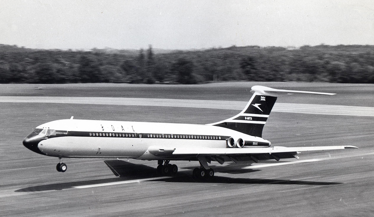 In March 1964, we participated in BOAC’s route proving trials with the VC-10. This involved the Division having an engineer on board every flight that BOAC made; to places such as Lagos and Kano in Nigeria, Khartoum in the Sudan and across the Atlantic to Montreal. The prototype VC10, G-ARTA, is pictured above taking off from Wisley in August 1962.
Photo courtesy of P Robinson (copyright BAE-SYSTEMS) and Jelle Hieminga (www.vc10.net)
The trials were not just aimed at testing the aeroplane but all of its on-board systems. This meant that, generally, two complete crews, cabin staff as well as flight deck crew, were carried. All personnel on board, contractors representatives as well as the airline’s stand-by crew, were given a full cabin service just as if we were fare-paying passengers.
 As we have said, the purpose of the flights was to check out and prove all of the on-board systems. In our case that meant noting the accuracy against ground-based aids such as radio beacons and recording other parameters such as signal-to-noise ratio and if, and when, the system unlocked when flying over calm water or desert.
Finally we had to determine that the system could be coupled to the aircraft’s autopilot. This meant spending several hours in the radio bay, situated under the floor of the forward galley, with a tape recorder (see above) recording the electrical signals that would ultimately be fed to the autopilot enabling the aircraft to fly accurately from waypoint to waypoint.
The VC-10 made its first fare-paying flight from London to Lagos on the 29th April 1964. It remained in service until 1981 and, in 2009, still held the record for the fastest crossing of the Atlantic by a sub-sonic transport aircraft.